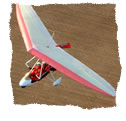
|
Ahead of us lay a 3 hour trip of 240 miles. The high pressure was starting to slip away to the North-East and we had already been fortunate with the weather. We didn’t want to push our luck.
Our route would take us back to the mainland via the Orkneys, past Wick, and then down to Dornoch airfield in Invernesshire. We planned to meet up with some fellow flyers, Brian and Nancy, who I had met on an earlier trip. Brian planned to leave us 20 litres in his trailer and we arranged to meet at Insch, 1 hours flying away to the South-East.
Climbing to 5000ft once more above a milky inversion, we tracked south. The visibility was 15km and we could see Sumburgh from Lerwick. Below us was a calm sea a welcome change from the white-topped rollers that had greeted us on the trip up.
Sumburgh handed us over to Kirkwall as we passed overhead their airfield at 5000ft.
”G-AZ, report crossing Pentland Firth”.
I could hear an ATC conversation going on between Kirkwall and some military helicopters. As I was reporting our position, two 2 Tiger Helicopters appeared in our 11 o’clock position, at the same height of 5000ft and ½ a mile away.
“G-AZ, visual with helicopter traffic, same height.”
They passed down our left side and I was still surprised to have seen them at such altitude. My passenger and I discussed the merits of the busy radio work we had been doing throughout the trip, and how it had paid off!
Passing overhead Wick we were happy to be heading south again and into a generally more weather-stable part of the country, with less winds…
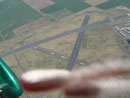
2 hours later, Inverness came into view and then Dornoch, sitting precariously on the edge of the Tain Range bombing area. Time was getting on, and it was already 14:30. We uploaded the badly needed 20 litres of fuel Brian had left us in his trailer.
We had a slight tailwind to Insch as we skirted around the edge of Grampian mountains, to be sure of keeping clear of the Aberdeen airspace. Trees stretched out below us and we caught a lot of thermals mixed in with the rotor turbulence from the mountains which made for a bumpy ride.
With Insch lying in a valley, we kept our speed up at 70MPH, expecting some nasty rotor as we went in. Zooming along the runway, I flared and we settled onto the grass smoothly having avoided any real wind gradient.
Partly lottery grant funded, the Insch clubhouse is set on two levels and feels more like a comfortable house with armchairs.
Brian and Nancy were already there and we had only half an hour before we had to refuel and push on to Brunton Airfield, Northumberland.
The air was moist from the local sea and air conditions as we followed the coast, and the visibility had reduced to 5km as we crossed the Firth of Forth at 5,000ft. The sun was glowing orange and inching lower in the sky. Once more we found ourselves with water below and the hope that the engine would continue purring for the next 16 miles..
|